Geophysics
Geophysics /dʒiːoʊfɪzɪks/ is a subject of natural science concerned with the physical processes and physical properties of the Earth and its surrounding space environment, and the use of quantitative methods for their analysis. The term geophysics sometimes refers only to the geological applications: Earth’s shape; its gravitational and magnetic fields; its internal structure and composition; its dynamics and their surface expression in plate tectonics, the generation of magmas, volcanism and rock formation. However, modern geophysics organizations use a broader definition that includes the water cycle including snow and ice; fluid dynamics of the oceans and the atmosphere; electricity and magnetism in the ionosphere and magnetosphere and solar-terrestrial relations; and analogous problems associated with the Moon and other planets.
The Study of extra terrestrial bodies and the study of tiltation, rotation, revolution and geophysical properties of different planets in the universe is being studied in one the branch of geophysics called as Solid State Geophysics .
The Major Branches of Geophysics are given Below.
- Mineral Geophysics.
- Mathematical Geophysics.
- Solid State Geophysics.
- Bio Geophysics.
- Geophysical Fluid Dynamics.
- Geodesy.
- Heat Dynamics.
- Geomagnetism.
- Seismology.
- Near Surface Geophysics.
- Tectonophysics.
- Borehole Geophysics.
- Micro Geophysics.
- Exploration Geophysics.
Exploration Geophysics

Exploration geophysics is an applied branch of geophysics, which uses physical methods, such as seismic, gravitational, magnetic, electrical and electromagnetic at the surface of the Earth to measure the physical properties of the subsurface, along with the anomalies in those properties. It is most often used to detect or infer the presence and position of economically useful geological deposits, such as ore minerals; fossil fuels and other hydrocarbons; geothermal reservoirs; and groundwater reservoirs.
Exploration geophysics can be used to directly detect the target style of mineralization, via measuring its physical properties directly. For example, one may measure the density contrasts between the dense iron ore and the lighter silicate host rock, or one may measure the electrical conductivity contrast between conductive sulfide minerals and the resistivity silicate host rock.
The main techniques used are:
- Seismic tomography to locate earthquakes and assist in Seismology
- Reflection seismology and seismic refraction to map the surface structure of a region.
- Geodesy and gravity techniques, including gravity gradiometry.
- Magnetic techniques, including aeromagnetic surveys to map magnetic anomalies.
- Electrical techniques, including electrical resistivity tomography and induced polarization.
- Electromagnetic methods, such as magnetotellurics, ground penetrating radar, transient/time-domain electromagnetics and SNMR.
- Borehole geophysics, also called well logging.
- Remote sensing techniques, including hyperspectral imaging.
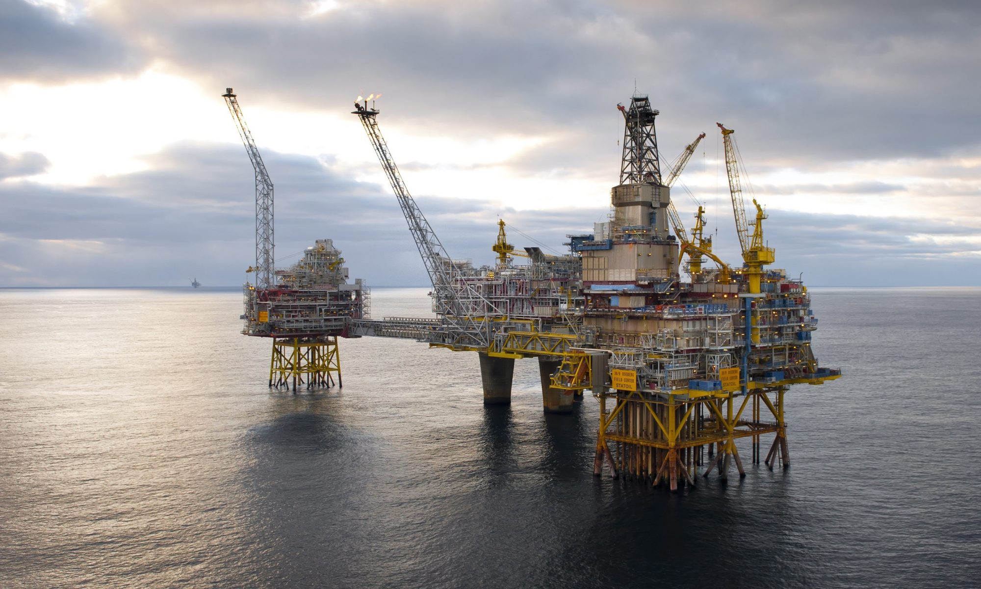
Geophysical Surveys for Oil & Gas Exploration
When any operator company own the exploratory block for the hydrocarbon exploration. The first step is to know that whether the seismic survey done in particular block area or not. If the survey has already done on block then the new operator company acquire that data for further knowing the prospects regarding exploration of hydrocarbon reservoirs.
If the seismic survey never been conducted into the block or the previous survey wasn’t shows satisfactory result, then the operator company hires the seismic acquisition company. There are two kinds of reflection surveys conducted to find the reservoir.
The two major type of seismic reflection surveys are: 1. 2-D Reflection survey
2. 3-D Reflection survey.
2-D Seismic Reflection Survey.
Seismic Reflection
The reflection of elastic waves at boundaries between different rock formations, especially as a technique for prospecting or research.
Types on Seismic surveys on the basis of Terrains.
- On- shore Land Survey.
- Off- shore Ocean or Sea Survey.
Types of Seismic Waves
The seismic reflection waves are of two major types that is useful in the exploration industry .
- P- Wave. (Primary Waves) ( Compression Waves)
- S- Wave. ( Secondary Waves) ( Shearing Waves)
- Rest of the waves are Rayleigh waves, L- Waves, Surface Waves or Ground rolls.
In exploration industry P waves played an important role and P wave has the fastest velocity among all waves. The velocity of P wave affected through the aquifers or because of the fluid. S waves are shearing waves hence it cannot affected because of aquifers because of this weakness of S wave, no one give priority to this wave. But for the comparison and to counter check the p wave results the s waves used for the correlation.


Methodology
First of all the operator company tells the plan and give the survey design to the contractor company. The number of Dip lines & the number of Strike lines recorded on the block. The offset distances between the receivers and the offset distance between the source is selected by the operator. But to set the parameters for the particular block the test line should be run. During testing the parameters can be varied to know the best results, wherever operator got their desired result in possible economical way. The selected parameters then followed throughout the survey.
Usually the offset between the receivers are 20 to 30 meters & the offset between the source is 40 or 30 or 20 meters depends on the terrain & the desired depth to achieve target horizon. The Quality of the reflectors depends upon the number of folds of the reflector. An adequate number of folds should be selected by the operator so the best possible visibility of the target horizon can come up for the interpretation.
On land Usually following sources use during survey.
- Vibrator or Vibrosis.
- Dynamite.
- Air Gun.
- Tovex blast.


Following are the types of Receivers using during survey.
- Geophone.
- Marsh Geophone.
- Hydrophone.


After selecting all the parameters, the survey is conducted and the results of the survey is submitted to the operator company.
To know the bedrock and a static correction must be applied. The out most layer of earth crust is consist of loose sediments and the receivers are installed onto the surface of crust, hence the waves received on the geophone after crossing these loose sediments layers and this leads to the lag time. To correct this lag time a static refraction survey is conducted called as low velocity layer survey (LVL). LVL survey is helpful to know the depth of the bedrock and the velocity of the loose sedimentary beds above the bed rock. Later on when the survey completed this correction is added into the reflection survey result to correct the velocities of these layers and helpful for the removal of lag time. The correction in data processing is called as static correction or static tomography technique.


3-D Seismic Reflection Survey
3D survey is carried on when there is any significant potential seen after the interpretation of 2D survey results, 3D survey is way expensive survey then 2D survey and 3D survey always carried on in confined selected areas. The Number of seismic lines increases and very closed spaced to each other and sources are set as cross line and receivers are always on cross line. In 2D survey only one inline line is used contrary in 3D more than 8 or 12 or 14 or 16 lines are active and so on. Same sort of receivers and sources are used in 3D but the volume of usage increasing excessively. The cost of 3D data acquisition, processing and interpretation increases significantly but in return more chances for successful exploration possible.
After the 3D survey the geoscientists are able to interpret the earth interior structures in more detail. Can able to tell the exact position and volume of the reservoir and estimated production yield upon the completion of well. The resolution also improved through the 3D survey and 3D survey enables to show the complex small structures as well.


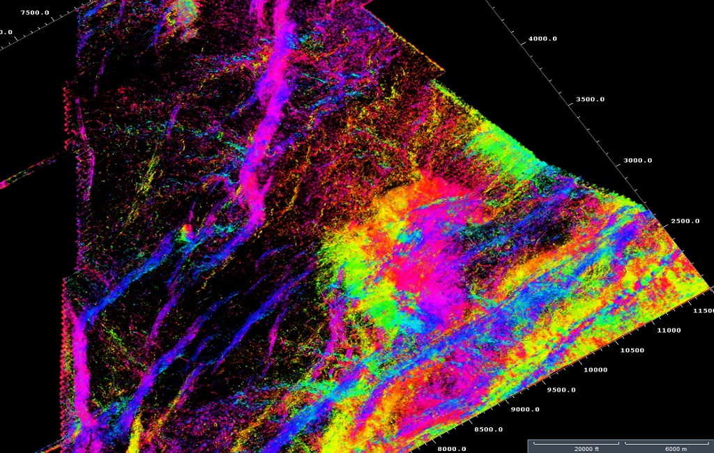
Above images are of 3D survey designs and plannings.
Sample of 3D Seismic sections images are given below
4D Seismic Reflection Survey
When the production from the reservoir through the well getting started and after a long time when the reservoir starts depleting. The 3D survey repeated once more to know the current condition of the reservoir and the affects on subsurface after the extraction of hydrocarbon. After the survey completed geoscientist explored the possible economical ways to enhance the production from the depleting reservoir.
From the above statements it has been concluded that the 4th dimension is time dependent and its time. After spending a long time the 3D survey repeated and called as 4D survey.
Seismic Reflection Survey Related Videos and Lectures
Lecture No. 01:
Lecture No. 02:
Seismic reflection Videos:
3D- Seismic Survey Off- Shore:
Seismic Survey Views:
Sercel 428 xl Acquisition Unit:

You put really very helpful information.
LikeLike